The Burnett County GIS website http://burnettcowi.wgxtreme.com/ allows you to search and explore properties and owner information for the entire county. You can change the layers and use different aerial maps taken at different times of year over the past 15 years and save and print screen shots. It is a pretty neat tool! Other counties in WI have similar sites. Isn’t technology cool?
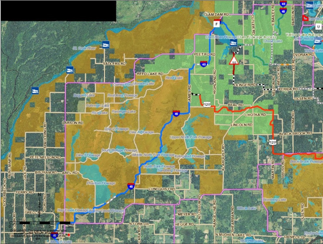
This map shows all the public lands and roads and trails between my home (bottom left) in Grantsburg and my land (top right) near Little Yellow Lake. It helps to explain why it can take me several hours to travel between the two properties, which are really only about 14 miles apart as the crow flies and about 23 miles via County Road F.